635 W State St

Commercial lot, Hurricane

You're standing on a half-acre commercial parcel on State Street in Hurricane, Utah.
Last reviewed 3 October 2026 · A two-minute read · 1896–1994
The short answer

The building on this half-acre lot on West State Street in Hurricane, Utah, was built in 1994 on ground platted as part of the Hurricane Field subdivision, part of the town's twentieth-century growth from farmland into commercial blocks near Hurricane High School and the Hurricane City Cemetery.
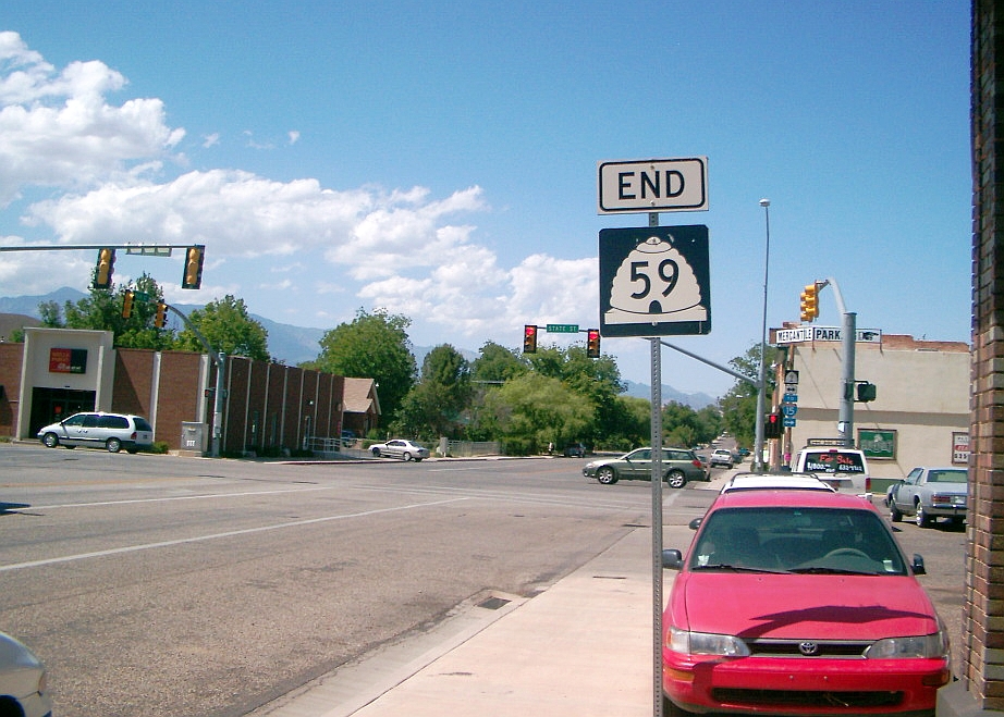
State Street and Main Street, Hurricane, Utah.
State Street and Main Street, Hurricane, Utah. — 2008 · Landry Heaton · CC BY 2.0
1994 to now

A 1994 building sits a quarter mile from the high school

You're on West State Street in Hurricane, Utah, on a small commercial lot just west of downtown. The building here, about 5,360 square feet, was built in 1994 on land platted as part of the Hurricane Field subdivision. Hurricane High School sits a quarter mile east, the only high school serving the town and its neighboring communities. A mile and a bit northeast, Hurricane City Cemetery has held burials since 1908.

1994 to now

Farmland platted as Hurricane Field became a shop lot

The lot sits in a stretch of ground once surveyed as Hurricane Field, farmland turned into town blocks as Hurricane grew through the twentieth century. The 1994 building replaced open field with commercial space, one of many small shops that filled in State Street as the town's population climbed. No prior structure or owner is tied to this exact half acre. The parcel has stayed commercial ground ever since, a plain working lot rather than a landmark.

A one-story commercial building from 1994 still stands on the lot today.

Read the ground you are standing on

Every person, building and event in this story opens into its own dig in the app — and Strata will dig the ground under your feet instead, wherever that is, in about a minute, with every source shown.

Get Strata on the App Store Free on iPhone · opens this place if you have it
On a computer? Point your iPhone camera here.

Where this is

37.175°N 113.297°W TILE ≈ 1.2 × 0.6 KM
Town
Hurricane
Country
United States
Tile
≈1.2 × 0.6 km (geohash6)
Last reviewed
3 October 2026

The layers, in order

Sourced records, high and medium confidence. Era background is marked as such.
Deep time
The ground beneath Hurricane is built from Quaternary basalt lava flows topped with sand and alluvium, the same dark volcanic rock exposed along the Hurricane Fault.
Era background — not a record of this tile · Macrostrat
Modern
About a kilometer from here stands the Hurricane Library-City Hall, listed on the National Register of Historic Places.
The Samuel and Elizabeth Isom House, a historic residence roughly 850 meters away, is listed on the National Register of Historic Places.
A kilometer east, the Emanuel and Ursella Stanworth House is another National Register-listed pioneer house in Hurricane.
About 1.7 kilometers away runs the Hurricane Canal, a National Register-listed irrigation project that settlers blasted and dug through basalt to water the valley starting in the 1890s.
Roughly 3 kilometers away, the Hurricane-LaVerkin Bridge is listed on the National Register of Historic Places.
1896
The town of Hurricane traces its founding to 1896, when Mormon settlers finished the Hurricane Canal and began farming the lava-rock bench above the Virgin River.
FamilySearch Places · record, high
1908
A short walk north, the Bradshaw House-Hotel dates to 1908 and is listed on the National Register of Historic Places.
1908
Hurricane City Cemetery, about 1.8 kilometers from here, has held the town's dead since 1908.
FamilySearch Places · record, high
1924
The oldest dated record within reach of this spot is Hurricane High School, founded in 1924 and still standing about 420 meters away.
Wikipedia / Wikidata · record, high
1965
Fletcher Skidmore, an American football player born in 1898, died in Hurricane in 1965.
Wikidata · record, medium
1994
This parcel, part of the Hurricane Field Survey Block 15, carries a commercial building the county assessor dates to 1994, on a 0.65-acre lot.

Questions about this place

Answered in one sentence, then in full above
What was here before the building on this lot?
The ground was part of Hurricane Field, farmland surveyed and platted into town blocks as Hurricane grew through the twentieth century. No prior structure or owner is tied to this exact half acre before the 1994 building.
When was the building on this lot built?
The building, about 5,360 square feet on a 0.65-acre lot, was built in 1994, part of the Hurricane Field Survey Block 15.
What happened at this site in Hurricane, Utah?
Open field platted as part of the Hurricane Field subdivision was replaced by a commercial building in 1994, one of many small shops that filled in State Street as the town's population grew.
How old is Hurricane High School compared to this lot?
Hurricane High School, a quarter mile east, opened in 1924, seventy years before the 1994 building on this lot.
Is there a cemetery near this lot?
Hurricane City Cemetery, about 1.8 kilometers away, has held burials since 1908.

Where this came from

1
Wikipedia / Wikidata — Hurricane High School opened nearby in 1924
2
Washington County Assessor via UGRC parcel layer — The lot at W State St was platted and built in 1994
3
FamilySearch Places — Hurricane was founded in 1896
4
Wikidata — Football player Fletcher Skidmore died in Hurricane
5
Wikidata / National Register of Historic Places — The Bradshaw House-Hotel, built 1908, stands a kilometer away
6
Wikidata / National Register of Historic Places — Hurricane Library-City Hall, a registered historic building
7
Wikidata / National Register of Historic Places — Samuel and Elizabeth Isom House, a listed pioneer home
8
Wikidata / National Register of Historic Places — Emanuel and Ursella Stanworth House, listed historic home
9
Wikidata / National Register of Historic Places — The Hurricane Canal, engineered through solid lava rock
10
FamilySearch Places — Hurricane City Cemetery established 1908
11
Wikidata / National Register of Historic Places — Hurricane-LaVerkin Bridge, a registered historic crossing

Dug nearby

A newer house on the edge of Hurricane
Hurricane
2 km
Open ground above the Virgin River
LaVerkin, Hurricane
3 km
Open farmland near Hurricane, Utah
LaVerkin, Hurricane
6 km
This is one spot. Strata reads the ground wherever you are standing. Free on iPhone